|
 |
 |
 |
 |
|
|
|
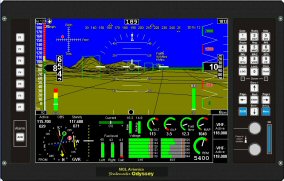
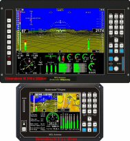
MGL Avionic Glass Cockpit Stratomaster ODYSSEY EFIS


 Click on pictures to enlarge them.
Odyssey is fully Enigma connectivity and database compatible and for the first time, offers a large, 10.4" sunlight readable TFT screen EFIS system that is fully featured, expandable and future proof at a price that is truly affordable.
Odyssey builds on the proven, exceptionally flexible platform provided by the runaway success of the Stratomaster Enigma EFIS. As with Enigma, Odyssey provides a fully user customizable system of unmatched flexibility.
Odyssey is the World's largest EFIS system at an unbelievably low price - with all the functions you would expect and a lot more. MGL puts the latest technology to work, efficiently and effectively - then makes use of a top-notch, World class, certified electronics production facility. We believe that technological advancement has to include lower cost. Only technological advancement combined with lower cost can truly be called progress. Odyssey is the latest proof of MGL's commitment to this and your flying pleasure
Dimensions 317 x 202 mm x 61mm, weight 1.9Kg.
Subscribe to our MGL information list
Request catalog/prices 
|
MGL Avionics Glass Cockpit Stratomaster ODYSSEY EFIS Features
Dimensions: 317x202 mm. Mounting depth 60mm (110mm including connectors & cables). Pannel cut 302x198 mm.
Download the cutting template
10.4" Top quality, wide temperature range, direct sunlight viewable TFT screen with non-reflective surface etch. VGA resolution (640x480)
Robust, composite and aluminium housing with control rich user interface including user assignable buttons and rotary controls.
For panel dimensions and cutout information download this document: Odyssey panel cutout.pdf.
Light weight, 1.9Kg, simple mechanical installation, no brackets required.
Features listed here are only some of the available functionality, Odyssey, like its smaller brother Enigma, is a dynamic and very flexible development. Odyssey includes all of the Enigma functionality and adds items related mainly to its additional interfaces (ARINC429 etc).
Software based additions to functionality are made available to end users via free and unrestricted internet download with the actual task of updating a system being a simple and quick process taking only a few seconds.
Odyssey is fully compatible with the Enigma database system and application programs, all of which are available free of charge via internet download. Please note that 3rd party applications created by other companies or individuals may require purchase or licensing. Contact the relevant owners/creaters of these applications directly for information.
Load a schematic describing the ODYSSEY database generation process. (Click here for PDF format)
Primary flight system features:
Altimeter: -700 to over 40.000 ft range, 1ft resolution at sea level.
Airspeed: 16mph to 250mph range (other ranges on request).
Vertical speed: +/-2000 ft/min analog displays, +/-10.000 ft/min digital displays. TE mode available.
AOA: 18 degrees nominal range (Range set during calibration flight).
Attitude:
Connects to either low cost SP-4 AHRS or high performance SP-5 AHRS including aerobatic versions of SP-5.
Magnetic heading (compass) using matchbox sized SP-2 for reliable remote installation.
Navigation:
Built in 16 channel WAAS GPS, can use external GPS NMEA feed if required.
Connection to standard NAV radios for ILS, Glide slope, VOR: RS232 serial, ARINC 429, +/-150mV analog inputs.
GPS only simulation of VOR navigation and ILS, Glide slope.
GLS (GPS landing system) with highway in the sky 3D navigation to runway threshold.
HITS (Highway in the sky) navigation system for GPS waypoints and routes.
3D terrain lookahead with free World-wide terrain database.
3D runways with live approach information without pilot interaction.
Moving map navigation using raster or vector maps.
Unrestricted ability for user to create and edit navigation data as well as raster and vector maps using free software applications.
Engine monitoring:
Single or dual engines, normally aspirated and turbine, fully flexible monitoring setup to cater for any type of engine.
Uses standard, low cost RDAC remote engine monitoring modules for ease of installation as well as J1939 (CAN bus) based engine monitoring.
EGT,CHT,Oil temp,Oil pressure,RPM,Coolant temp,fuel flow,fuel level(s),fuel pressure,voltage,current,... etc,etc.
Other features:
Automatic flight folio flight logging with export to PC based flight log viewer program (Enigma Flight Planner). Logs up to 1000 flights with internal viewer.
"Black box" style logging of all flight data (primary flight, navigation, attitude, engine monitoring) to SD card with free PC based viewing application including export of flight path to Google Earth.
Interface to COM and NAV radios for setting of frequencies from internal data base or rotary controls.
9 fully user customisable screens using free Odyssey Screen Designer and simulator software.
Layout your screens exactly the way you need them.
Voice prompts and warnings (if connected to suitable audio system), engine monitoring, navigation, primary flight etc. Voice prompts can be recorded to requirements using free PC application.
Fully "Enigma" map and database compatible.
Operates as single panel, dual or tripple panel system with full, unrestricted functionality in each panel.
Low power requirements, 1.5A at 12V at full backlight level.
Dual backlights with independent power supplies.
Connects to I/O extender for applications requiring large amount of additional monitoring and control such as remote control of Odyssey panel (using "hat switch" or similar on joystick).
Easy and fast software upgradability using SD card. Free updates for life, high frequency of update cycles.
Built in high capacity solid state hard drive (no moving parts, no G-force restrictions). All navigation data and maps may reside on internal drive.
Ability to operate fully from external SD card slot including external booting of system (emergency operation in case of hard drive failure or during system test and configuration).
User selectable units of operation, meters/feet, mph/knots/kmh, liters/galons etc
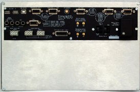
Interfaces:
RS232 port 1 - NAV/COM radio, FLARM, XAON XRX traffic systems, serial altitude encoder output
RS232 port 2 - NMEA autopilot output / external GPS input
ARINC429 - 1 x TX, 3 x RX. Normal and high speed. TX->Autopilot messages, RX->NAV radios, traffic information systems (ARINC 735).
USB Host - 2 x. Interconnect between multiple panels, MGL communications peripherals (Weather systems etc).
USB Device - 1 x.Interconnect between multiple panels (slave connection).
CAN (J1939). Automotive multidrop communications interface.
Analog - 4 x +/-150mV analog differential inputs for connection to older generation NAV receivers (ILS, Glide slope and flags).
Audio - high and low level outputs for audio voice prompts.
Airtalk - 2 x multidrop communications bus (MGL propriety bus). Used to connect MGL attitude and compass sensors.
Gillman altitude encoder output (standard parallel output bus).
Input for Rotor speed sensor (Rotor craft usage only).
GPS antenna input for active GPS antennas (SMA connector).
Power supply:
One input to 12V nominal supply. System operates from 6V to 28V.
One input/output for optional rechargeable backup battery (recomended sealed lead acid, 2-5A/H capacity). Built in current limited charger.
One secure 12V supply output for connection of vital equipment (AHRS, compass sensor, engine monitor(s)).
|
|
|
|
 |
 |
 |
 |
|
|